Projects
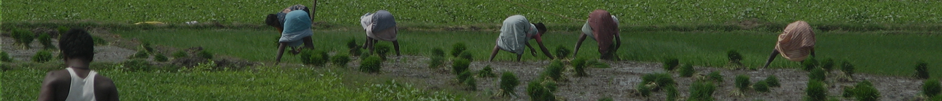
Agriculture
Completed Project
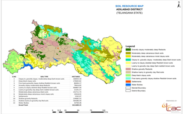
Soil Resource Mapping on 1: 50,000 scale and Creation of Soil database for five districts of Telangana using Satellite Data
Introduction:Soil forms one of the most precious natural resources of the earth. In order to meet the ever increasing food requirement of the growing population, there has been compulsion to produce more and more from each unit area of land; this process is leading to depletion of natural resources. Under these conditions knowledge of the soil, their extent, distribution, characteristics and potentials gains prominence in optimising land use on sustainable. “soil maps prepared for five districts of Telangana. namely Karimnagar, Medak, Warangal, Khammam and Nalgonda on 1:50,000 scale based on USDA Soil Classification which will meet the requirements of the various user agencies for generating information on soil behavior, appropriate use and management programmers”.
Objectives:- To map soil resources of five districts of Telangana. on 1: 50,000 scale for the base year 2011-12 using IRS LISSS- III satellite data,
- To create digital soil data base for the five districts based on NNRMS standards
- Collection of Database of Resource sat LISS-III data Zaid (April- May) seasons to address spatial soil resource information
- Pre field on-screen visual interpretation of different land degradation classes on satellite data FCC following standard visual interpretation techniques adopting USDA Soil Classification. Identification of sample points for various land degradation classes, ground truth collection, post field interpretation and finalization of maps.
- Digital geo-database would be developed as per NNRMS standards to address retrieval and storage of different data inputs and outputs, designing meta data elements relevant to different types of data, automated output production and interactive querying.