
Geomatics
In house project of TRAC for Ministry of Panchayat Raj Dept, Government of Telangana.
TRAC has extensively used Remote Sensing Satellite data and GIS techniques in preliminary planning of the project for entire state within a shortest period. The spatial network of the existing Rural Water Supply infrastructure is captured. Using Digital Elevation Model data the elevations of habitations that of surface water source were assessed, Habitations were either connected by gravity pipeline else through pumping pipeline to nearest hillock, from the source. About a total of 18,507 required structures were identified, about 4,430 Km of Main Grid, 44,466 Km of Sub-Grid and 38,506 Km of distribution network was analyzed and extracted. Based on the work of TRAC, estimations were prepared by RWS. Permissions were taken from railway department for identified crossing points of pipeline with Railway line and from the Forest department for the pipeline passing through the forest areas of about 910 acres.

In house project of TRAC for Ministry of Panchayat Raj Dept, Government of Telangana.
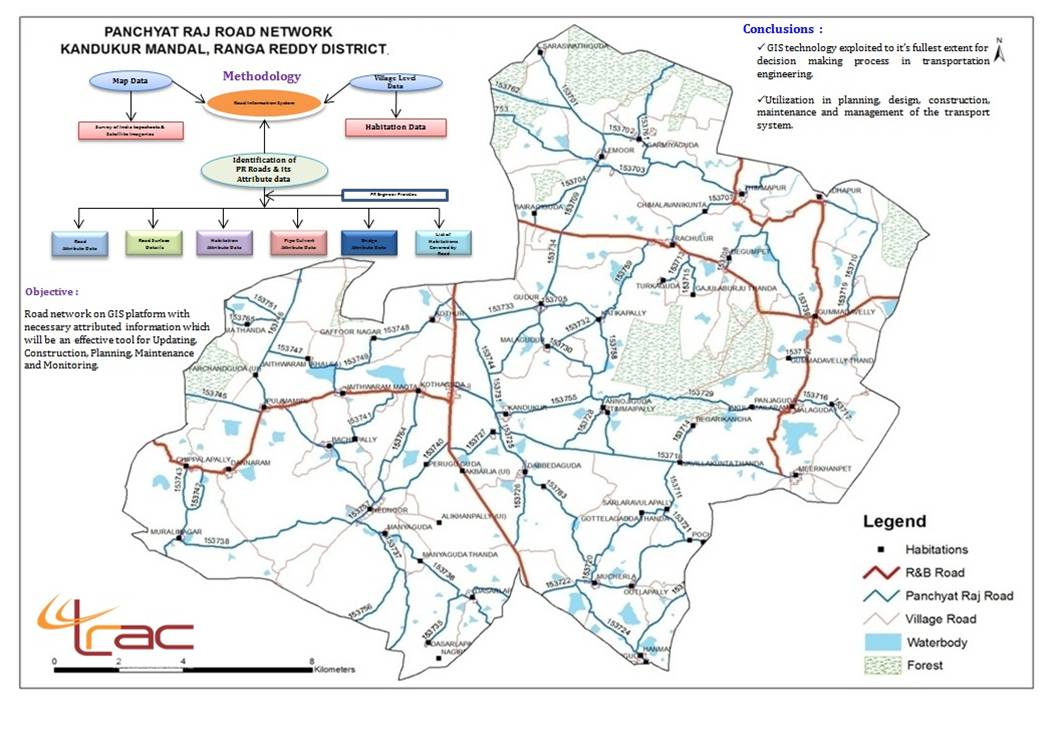
All the Panchayat Raj roads were identified and extracted from high resolution satellite data, Cartosat - 1. The surface type details were linked to the road information and Geodatabase was hosted in the NRSC Bhuvan Portal webserver, which is of immense use to the panchayatraj department.
Sponsored by National Remote Sensing Centre, ISRO, Department of Space, and Government of India.
TRAC has contributed to the spatial depiction of reliable Land and Water resources information at 1:10,000 scale to support effective Management of Natural Resources in Planning, Implementation and Monitoring of Developmental activities.
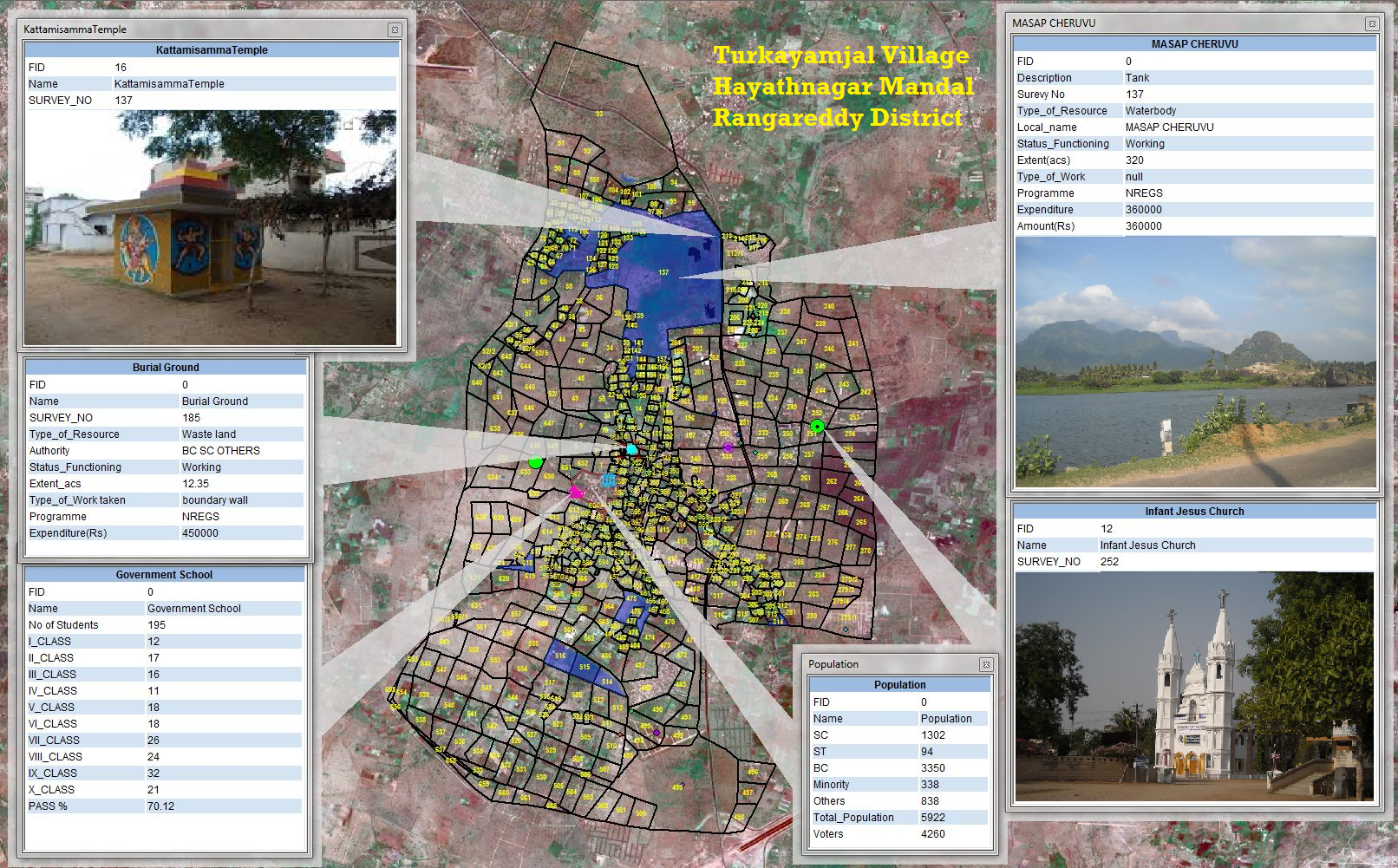
10,250 village cadastral maps have been digitized on high priority and submitted to ISRO/NRSC. The data would be hosted in Bhuvan Panchayat for development and monitoring of decentralized planning.